Flood Damage at Glentui Loop Track
May/June 2021 saw a huge amount of rain cause extensive flooding around the Cantebury area. As the river’s finally start to subside, the damage to Canterbury’s walking tracks is clear to see.
On the first dry Saturday following the floods, I headed out to Glentui Loop Track in North Canterbury, Waimakariri District, to stretch my legs and check out the track.
But to start with, here’s the warning from DOC, current as I write this on 6th June.
Alert for the Glentui Track: 2 June 2021: Glentui Loop Track temporary closure
Glentui Loop Track is closed until further notice due to two bridges in the section of track between the Bypass and Mt Richardson track junctions being washed out.
The Glentui Waterfall Track is open. The Mt Richardson and Bypass and Blowhard tracks have not yet been inspected so expect slips, washouts and tree fall on the these tracks.
We advise people not to walk these tracks until they are assessed. If you do, it is at your own risk and take extreme care.
First published on 2 June 2021. View current alerts in Caterbury on the DOC website.
When I headed to the Glentui Loop Track, just 30 minutes drive from my house, it was with the intention of walking the track until hitting a point that was clearly unsafe to pass. On arriving, I parked at the lower picnic area and passed a track sign to head to the lower bridge. This bridge was the highest above the water and looked unaffected. I knew the remaining two bridges were just a couple of feet above the streams their streams and could be passed without needing their use if required, so I contined with the plan to head around the track until it was unsafe to continue, and that being the case I could turn around and head back. As the loop takes me 45 minutes at a regular pace, I knew at any point on the loop I was no more than around 30 minutes or so from the car.
As a more detailed disclaimer, I have walked this loop many times and was familiar with the bridges and rivers/streams that would need to be crossed having stopped there many times before with my kids. As always when I go on a walk, I start an activity on my Garmin Instinct Solar watch. This starts a live activity feed that sends a link to my wife so that she can watch me on the route.
I over-prepare for any walk I do – even the < 1 hour family walks. I continue to do this despite the multiple comments I get from strangers on the same walk that carry nothing but a hand-held plastic water bottle. On this walk that I knew on a regular day I could cruise in 45 minutes, my backpack, pockets, and belt held my fully charged mobile phone with local maps saved to the device, two headtorches plus my waterproof Fenix torch, a spare set of batteries, a fully charged, high-powered USB powerbank, my Leatherman multitool, a full first aid kit, a waterproof jacket (the awesome Patagonia Torrentshell), my new Macpac insultated jacket, water and snacks, a hot mug of tea in my insulated Hydro Flask, waterproof gloves, a beanie and scarf, and more, with most of it sealed in a waterproof stuff sack. I even took along a couple of slings and karabiners from my rock climbing days in case I came across anyone who needed immediate assistance. Back at the car I keep another first aid kit, dry clothes and footwear, another water bottle, and more.
As an aside, I have a hazard identification certification and a ropes course qualification. I’ve completed many kilometres of hiking both in the UK and here in New Zealand, as well as plenty of rock climbing around Europe and NZ.
In short, I was well prepared, aware of the dangers, had family who knew where I was (at a frequency of every two minutes!), and I went to the track at my own risk, with a goal more of a quick stretch of the legs and a careful approach rather than the intention to actually complete the walk no matter what.
I’m writing this blog not to encourage others to take chances, but to share photos of the damage caused by the floods, which hopefully will help to educate others as to the extreme damage that can be caused. I met these sites in the dry, warm (my thermals were too much at 16 degrees!) at low altitude and a short distance from the car. This helped give me a clear-headed perspective on the hazard. I didn’t need to cross to get to safety.
Video Showing Damage to Glentui Loop Track and Bridges


Glentui River Flood Damage to Bridges
First up is the middle of the three bridges, located at -43.195759, 172.249875. The two bridges shown below are both west of the intersection with the Bypass Track, i.e. both line on the shortest part of the loop that lies between the Bypass Track and the carpark/picnic area. If travelling clockwise from the Bypass Track intersection, you would only pass the higher bridge which appears undamaged.


And below shows the third and final bridge if travelling anti-clockwise around the loop from the picnic area, or first bridge if travelling clockwise.


Further Track Damage Caused by Slips & Fallen Trees
As well as directly on the Glentui River’s tributaries themselves, there is further damage to the loop track. I counted three sites that are going to need some work. Two slips on the main track and some decent tree fall to one spot on the short side-track to the waterfall lookout.


When hiking in New Zealand, always be prepared for unexpected changes in weather. Check the weather forecast, let people know where you’re going, when you’ll be back, and the vehicle you’re in and where you’ll park. Always take a backpack with the appropriate gear.
Helpful resources:
 https://nzraw.co.nz/wp-content/uploads/2024/07/mackintosh-beach-waipara-walks-10.jpg
1067
1600
Mark
https://nzraw.co.nz/wp-content/uploads/2020/06/nz-raw-logo.png
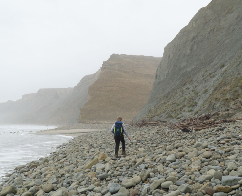
Mark2024-07-21 15:34:162024-07-21 15:54:27MacKintosh Beach Family Walk Near Waipara, North Canterbury
https://nzraw.co.nz/wp-content/uploads/2024/07/mackintosh-beach-waipara-walks-10.jpg
1067
1600
Mark
https://nzraw.co.nz/wp-content/uploads/2020/06/nz-raw-logo.png
Mark2024-07-21 15:34:162024-07-21 15:54:27MacKintosh Beach Family Walk Near Waipara, North Canterbury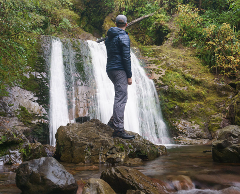 https://nzraw.co.nz/wp-content/uploads/2023/06/picture-takashima-jacket-review-new-zealand.jpg
908
1210
Mark
https://nzraw.co.nz/wp-content/uploads/2020/06/nz-raw-logo.png
Mark2023-06-30 08:57:142023-06-30 08:57:14Review of the Picture Takashima Jacket
https://nzraw.co.nz/wp-content/uploads/2023/06/picture-takashima-jacket-review-new-zealand.jpg
908
1210
Mark
https://nzraw.co.nz/wp-content/uploads/2020/06/nz-raw-logo.png
Mark2023-06-30 08:57:142023-06-30 08:57:14Review of the Picture Takashima Jacket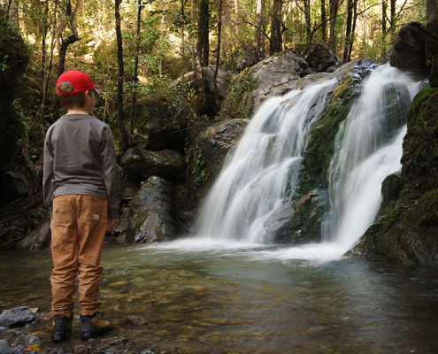 https://nzraw.co.nz/wp-content/uploads/2023/01/waterfalls-nz-800x600-1.jpg
600
800
Mark
https://nzraw.co.nz/wp-content/uploads/2020/06/nz-raw-logo.png
Mark2023-01-06 16:46:302023-01-11 13:30:04Best Family Friendly Waterfalls of Mid-South Island New Zealand
https://nzraw.co.nz/wp-content/uploads/2023/01/waterfalls-nz-800x600-1.jpg
600
800
Mark
https://nzraw.co.nz/wp-content/uploads/2020/06/nz-raw-logo.png
Mark2023-01-06 16:46:302023-01-11 13:30:04Best Family Friendly Waterfalls of Mid-South Island New Zealand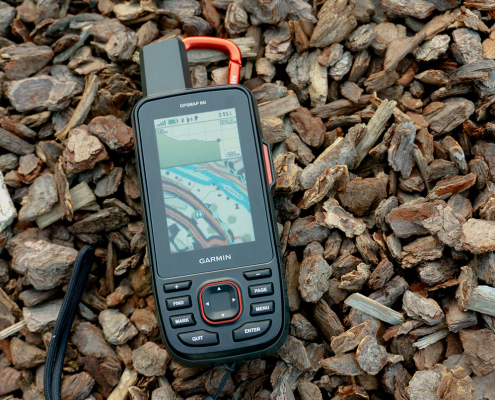 https://nzraw.co.nz/wp-content/uploads/2022/04/garmin-66i-gps-showing-map.jpg
806
1210
Mark
https://nzraw.co.nz/wp-content/uploads/2020/06/nz-raw-logo.png
Mark2022-04-23 16:15:202023-06-28 13:41:39Why I chose a Garmin 66i inReach GPS device
https://nzraw.co.nz/wp-content/uploads/2022/04/garmin-66i-gps-showing-map.jpg
806
1210
Mark
https://nzraw.co.nz/wp-content/uploads/2020/06/nz-raw-logo.png
Mark2022-04-23 16:15:202023-06-28 13:41:39Why I chose a Garmin 66i inReach GPS device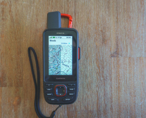 https://nzraw.co.nz/wp-content/uploads/2022/04/garmin-66i-showing-new-zealand-topo-50-maps-1.jpg
806
1210
Mark
https://nzraw.co.nz/wp-content/uploads/2020/06/nz-raw-logo.png
Mark2022-04-09 12:12:282022-04-23 16:08:42How to add NZ topo maps to a Garmin GPS device (for free)
https://nzraw.co.nz/wp-content/uploads/2022/04/garmin-66i-showing-new-zealand-topo-50-maps-1.jpg
806
1210
Mark
https://nzraw.co.nz/wp-content/uploads/2020/06/nz-raw-logo.png
Mark2022-04-09 12:12:282022-04-23 16:08:42How to add NZ topo maps to a Garmin GPS device (for free)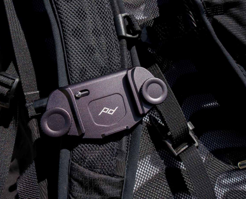 https://nzraw.co.nz/wp-content/uploads/2022/01/review-peak-design-capture-clip-v3.jpg
908
1210
Mark
https://nzraw.co.nz/wp-content/uploads/2020/06/nz-raw-logo.png
Mark2022-01-08 16:08:332022-04-09 08:37:28Peak Design Capture Clip v3 Review
https://nzraw.co.nz/wp-content/uploads/2022/01/review-peak-design-capture-clip-v3.jpg
908
1210
Mark
https://nzraw.co.nz/wp-content/uploads/2020/06/nz-raw-logo.png
Mark2022-01-08 16:08:332022-04-09 08:37:28Peak Design Capture Clip v3 Review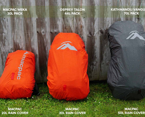 https://nzraw.co.nz/wp-content/uploads/2021/11/macpac-rain-covers-on-packs.jpg
1067
1600
Mark
https://nzraw.co.nz/wp-content/uploads/2020/06/nz-raw-logo.png
Mark2021-11-13 18:07:322022-04-09 08:37:40Macpac Waterproof Pack Cover Sizing
https://nzraw.co.nz/wp-content/uploads/2021/11/macpac-rain-covers-on-packs.jpg
1067
1600
Mark
https://nzraw.co.nz/wp-content/uploads/2020/06/nz-raw-logo.png
Mark2021-11-13 18:07:322022-04-09 08:37:40Macpac Waterproof Pack Cover Sizing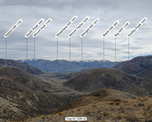 https://nzraw.co.nz/wp-content/uploads/2021/10/app-for-identifying-peaks.jpg
908
1210
Mark
https://nzraw.co.nz/wp-content/uploads/2020/06/nz-raw-logo.png
Mark2021-10-24 09:24:542022-04-09 08:37:53Identify Peaks with the PeakFinder App
https://nzraw.co.nz/wp-content/uploads/2021/10/app-for-identifying-peaks.jpg
908
1210
Mark
https://nzraw.co.nz/wp-content/uploads/2020/06/nz-raw-logo.png
Mark2021-10-24 09:24:542022-04-09 08:37:53Identify Peaks with the PeakFinder App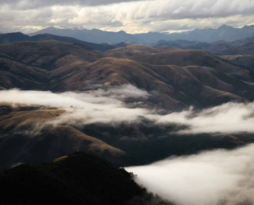 https://nzraw.co.nz/wp-content/uploads/2021/07/mt-thomas-walk-canterbury-08.jpg
900
1600
Mark
https://nzraw.co.nz/wp-content/uploads/2020/06/nz-raw-logo.png
Mark2021-07-18 12:47:582021-07-18 12:50:53Mount Thomas Walk in North Canterbury
https://nzraw.co.nz/wp-content/uploads/2021/07/mt-thomas-walk-canterbury-08.jpg
900
1600
Mark
https://nzraw.co.nz/wp-content/uploads/2020/06/nz-raw-logo.png
Mark2021-07-18 12:47:582021-07-18 12:50:53Mount Thomas Walk in North Canterbury

Leave a Reply
Want to join the discussion?Feel free to contribute!