Tiromoana Bush Walkway
1 January 2021 / Walks / Mark Lincoln
A 3-4 hour loop with a number of points of interest throughout.
The half-day Tiromoana Bush Walkway near Waipara in North Canterbury won’t appear in any DOC guides as it’s on land owned by Transwaste Canterbury. As such, if rules aren’t followed – such as respecting current COVID-19 rules (don’t use the toilets) or disturbing any farming activity – then they will close the walkway.
Disclaimer aside, the route itself is a very pleasant walk thanks to its rolling hills with some steep sections, its wide coastal views, and its numerous points of interest. These include:
- Barbara’s Lookout
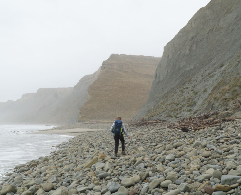
- A secluded beach with interesting stones
- The Te Ara Matairangi monument
- Kate Pond
- Ella Peak
- Te Ara Kānuka forest


The beach is a nice place for a coffee and a kiss (chocolate or otherwise!?).
Check out my review of the Hydro Flash mug.

The author at the Te Ara Matairangi monument, looking north.
Walk Overview
The trailhead at the car park is pretty much the highest point of the route and features a large and informative sign and map, along with brochures that can be taken (return at the end if no longer required).
The rolling terrain is about 5% forest floor, 30% dustry gravel tracks/farming roads, and 65% grassy track. The latter is basically as if a wide lawn mower has been driven along the route through tall grass. If it hasn’t been mown for a while and it’s rained recently, be sure to wear waterproof footwear.
While most of the track is open, a short detour takes you through the Te Ara Kanuka forest which – in combination with other areas of the route – features black beech, five-finger, kahikatea, kānuka, kōhūhū, lacebark, mānuka, ngaio, ribbonwood and tōtara.
The trail has a number of return side routes that you can choose to take depending on how much time you have. These include:
- Barbara’s Lookout, near the start and just 5 min return
- a walk through overgrown bush to a secluded beach (20 min return)
- a short, easy return route to the monument (10 min return and the highlight of the route)
- a 5 min return to Kate Pond with an information board and picinic table
- a 50 min, fairly steep return to Ella Peak, 346m
I started the Ella Peak route on my first visit then realised I hadn’t really left myself much time, so returned a couple of weeks later. To be honest, once you’ve had the interesting coastal views on the main trail, the views from Ella Peak didn’t add a huge amount. The inland views are hidden behind trees and while the cropped view to the south does provide you with views through to Christchurch and beyond, the view kinda pales in comparison to what you can already see to the west and north on the rest of the trail. Still, it’s nice to tick it off!


Track Length and Duration
The Transwaste website tells you the main circuit will take 3 to 4 hours and is 10.4km. This is probably about right if you exclude the side trips; particualrly Ella Peak which will add up to an hour extra.
For me, time passed pretty quickly on this walk. The lookout, beach, monument, and pond are great places to stop and it’s easy to lose track of time. Especially if you’re into photography. This could be a problem if someone is waiting for you at home as there is little to no phone signal on this walk so you have no way of keeping anyone updated should your track time extend beyond your initial estimate.
I tracked this route using the Alltrails app as well as my Garmin watch. Taking the side trips to the beach, the monument, and the pond but excluding Ella Peak; Alltrails (via my phone) recorded my distance at 13.3km and Garmin (via my watch) at 12.3km although both recorded the time as 2h 45min moving (4h 41m total iuncluding my stops).

Tiromoana Bush Walk Elevation Profile
shown against time taken
Getting There
The track has its own Google Maps location to make it easy to get to. Click this link, view the map below, or search for ‘Tiromoana Bush Walk’. This takes you to the car park on Mount Cass Road. If you’re heading north from Christchurch on State Highway 1, you’ll be taking a right onto Mount Cass Road just after the Wairapa River.
Mount Cass Road is a mix of sealed and gravel surfaces. Near the beginning of this road you’ll see a large sign letting you know whether the walkway is open or not.
Points of Interest
As mentioned, the multiple points of interest provide some good excuses to stop and have a snack or whip out the camera. Just keep an eye on the time as if you’re running late there’s no phone signal to update those interested in your return!

Barabara’s Lookout

The Secluded Beach

Te Ara Matairangi Monument

Te Ara Matairangi Monument

Ella Peak, 346m

Kate Pond
Suitability
The track is wide, clear, and largely either stoney gravel or grass. There’s a short portion through a forest, a few climbs through deer fences, and a number of fairly steep sections. It can be very windy on exposed areas and, once you’re into the main walk, the only way back to the car is via an uphill climb.
I did this walk on my own in just under 3 hours of moving time. It’s suitable for young childern although expect to carry them on the steeper sections or prepare yourself with lots of treats/bribes and allow plenty of extra time.
There are a few clifftops to watch out for and if the ground’s wet then the steep sections could be a little hazardous. Also be aware that the area is an active farm; I had to get out of the way quickly as a tractor rounded a corner.
Dogs are not allowed on the route at all. In fact, there was a needlessly agressive sign at the start about dogs being shot on sight :/
Final Note
As mentioned, be aware that there is very little phone signal on this route. On my second visit I had a low phone signal at the car park (on my first I had no signal here), another on the gravel tops track, and then another on the route up Ella Peak, but nothing on the rest of the route.
This gave my wife a little heart attack while she was monitoring my progress via Garmin LiveTrack and Alltrails Lifeline. The signal dropping meant that she received an alert at her end, and then when she checked the map it showed a straight line off the top of Ella Peak with no further movement! Sometimes technology can add a little more worry than necessary, I guess!
 https://nzraw.co.nz/wp-content/uploads/2024/07/mackintosh-beach-waipara-walks-10.jpg
1067
1600
Mark
https://nzraw.co.nz/wp-content/uploads/2020/06/nz-raw-logo.png
Mark2024-07-21 15:34:162024-07-21 15:54:27MacKintosh Beach Family Walk Near Waipara, North Canterbury
https://nzraw.co.nz/wp-content/uploads/2024/07/mackintosh-beach-waipara-walks-10.jpg
1067
1600
Mark
https://nzraw.co.nz/wp-content/uploads/2020/06/nz-raw-logo.png
Mark2024-07-21 15:34:162024-07-21 15:54:27MacKintosh Beach Family Walk Near Waipara, North Canterbury https://nzraw.co.nz/wp-content/uploads/2024/02/aircraft-fighting-port-hills-fire-christchurch-2024.jpg
908
1210
Mark
https://nzraw.co.nz/wp-content/uploads/2020/06/nz-raw-logo.png
Mark2024-02-16 09:32:552024-02-16 09:52:34Port Hills Fire, Christchurch 2024
https://nzraw.co.nz/wp-content/uploads/2024/02/aircraft-fighting-port-hills-fire-christchurch-2024.jpg
908
1210
Mark
https://nzraw.co.nz/wp-content/uploads/2020/06/nz-raw-logo.png
Mark2024-02-16 09:32:552024-02-16 09:52:34Port Hills Fire, Christchurch 2024 https://nzraw.co.nz/wp-content/uploads/2023/11/photos-stuck-syncing-in-lightroom.png
907
898
Mark
https://nzraw.co.nz/wp-content/uploads/2020/06/nz-raw-logo.png
Mark2023-11-21 08:31:362023-11-21 08:31:36Photos Stuck Syncing in Lightroom Classic? Here’s the Fix
https://nzraw.co.nz/wp-content/uploads/2023/11/photos-stuck-syncing-in-lightroom.png
907
898
Mark
https://nzraw.co.nz/wp-content/uploads/2020/06/nz-raw-logo.png
Mark2023-11-21 08:31:362023-11-21 08:31:36Photos Stuck Syncing in Lightroom Classic? Here’s the Fix https://nzraw.co.nz/wp-content/uploads/2023/06/picture-takashima-jacket-review-new-zealand.jpg
908
1210
Mark
https://nzraw.co.nz/wp-content/uploads/2020/06/nz-raw-logo.png
Mark2023-06-30 08:57:142023-06-30 08:57:14Review of the Picture Takashima Jacket
https://nzraw.co.nz/wp-content/uploads/2023/06/picture-takashima-jacket-review-new-zealand.jpg
908
1210
Mark
https://nzraw.co.nz/wp-content/uploads/2020/06/nz-raw-logo.png
Mark2023-06-30 08:57:142023-06-30 08:57:14Review of the Picture Takashima Jacket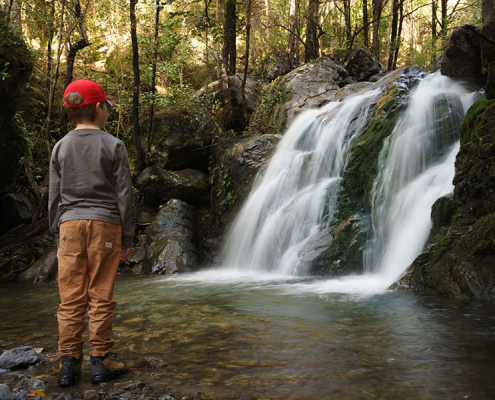 https://nzraw.co.nz/wp-content/uploads/2023/01/waterfalls-nz-800x600-1.jpg
600
800
Mark
https://nzraw.co.nz/wp-content/uploads/2020/06/nz-raw-logo.png
Mark2023-01-06 16:46:302023-01-11 13:30:04Best Family Friendly Waterfalls of Mid-South Island New Zealand
https://nzraw.co.nz/wp-content/uploads/2023/01/waterfalls-nz-800x600-1.jpg
600
800
Mark
https://nzraw.co.nz/wp-content/uploads/2020/06/nz-raw-logo.png
Mark2023-01-06 16:46:302023-01-11 13:30:04Best Family Friendly Waterfalls of Mid-South Island New Zealand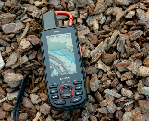 https://nzraw.co.nz/wp-content/uploads/2022/04/garmin-66i-gps-showing-map.jpg
806
1210
Mark
https://nzraw.co.nz/wp-content/uploads/2020/06/nz-raw-logo.png
Mark2022-04-23 16:15:202023-06-28 13:41:39Why I chose a Garmin 66i inReach GPS device
https://nzraw.co.nz/wp-content/uploads/2022/04/garmin-66i-gps-showing-map.jpg
806
1210
Mark
https://nzraw.co.nz/wp-content/uploads/2020/06/nz-raw-logo.png
Mark2022-04-23 16:15:202023-06-28 13:41:39Why I chose a Garmin 66i inReach GPS device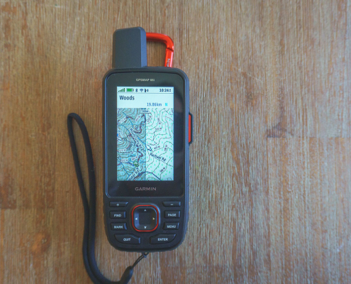 https://nzraw.co.nz/wp-content/uploads/2022/04/garmin-66i-showing-new-zealand-topo-50-maps-1.jpg
806
1210
Mark
https://nzraw.co.nz/wp-content/uploads/2020/06/nz-raw-logo.png
Mark2022-04-09 12:12:282022-04-23 16:08:42How to add NZ topo maps to a Garmin GPS device (for free)
https://nzraw.co.nz/wp-content/uploads/2022/04/garmin-66i-showing-new-zealand-topo-50-maps-1.jpg
806
1210
Mark
https://nzraw.co.nz/wp-content/uploads/2020/06/nz-raw-logo.png
Mark2022-04-09 12:12:282022-04-23 16:08:42How to add NZ topo maps to a Garmin GPS device (for free)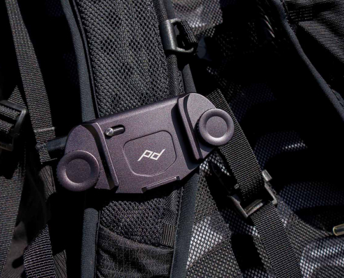 https://nzraw.co.nz/wp-content/uploads/2022/01/review-peak-design-capture-clip-v3.jpg
908
1210
Mark
https://nzraw.co.nz/wp-content/uploads/2020/06/nz-raw-logo.png
Mark2022-01-08 16:08:332022-04-09 08:37:28Peak Design Capture Clip v3 Review
https://nzraw.co.nz/wp-content/uploads/2022/01/review-peak-design-capture-clip-v3.jpg
908
1210
Mark
https://nzraw.co.nz/wp-content/uploads/2020/06/nz-raw-logo.png
Mark2022-01-08 16:08:332022-04-09 08:37:28Peak Design Capture Clip v3 Review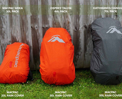 https://nzraw.co.nz/wp-content/uploads/2021/11/macpac-rain-covers-on-packs.jpg
1067
1600
Mark
https://nzraw.co.nz/wp-content/uploads/2020/06/nz-raw-logo.png
Mark2021-11-13 18:07:322022-04-09 08:37:40Macpac Waterproof Pack Cover Sizing
https://nzraw.co.nz/wp-content/uploads/2021/11/macpac-rain-covers-on-packs.jpg
1067
1600
Mark
https://nzraw.co.nz/wp-content/uploads/2020/06/nz-raw-logo.png
Mark2021-11-13 18:07:322022-04-09 08:37:40Macpac Waterproof Pack Cover Sizing

Leave a Reply
Want to join the discussion?Feel free to contribute!