3 Mapping & Route Planning Apps for Hikers
I recently bought a Gamin Instinct GPS watch which lets you upload a pre-made navigation route to it, then direct you along the route via a map on the watch. This set me on a path (ha!) to find the best route planning app for hikers. An app that lets you create a route on a map and then either navigate it through the app or export it to a GPS device or watch.
There are quite a few options out there, and just two or three stand out as the most popular. BUT what I found during my research is that some of the top apps miss some very useful features that can be found in other apps that just take a little more scrolling in the app store to find.
Features to look for…
It depends a little on what you’re after, of course. The core features that you may want from a hiking route app include:
- The best map/overlay to suit your needs (there are more than you think!)
- The ability to create your own routes and view route information
- The ability to navigate those routes from your mobile or export to another device (like a GPS unit or watch)
- A history of your completed routes, including your stats
- The ability to access the software on mobile, tablet, and on desktop computer/laptop
- A community that create and share routes (that you can then add to your plan), route reviews, and photos
- Bonus points: good pricing and quality support from the app developers
While some apps tick a fair few of these boxes, it’s worth a second look to see just how deep the functionality goes. Let’s cover some of that first before looking into the apps themselves.
Maps & Overlays
You’re no doubt very familiar with Google and Apple Maps. While these maps are excellent for street navigation and business locations, they’re not designed for away-from-the-road hiking trail information, plus app developers probably have to pay a reasonable license fee in order to use them, and they can be quite difficult for the community to add information to.
Instead, there are some excellent base map options out there that include comprehensive outdoors features, such as tracks, scenic sites, and even long-drop toilets! Some of those are OpenStreetMap, Mapbox, and Thunderforest, (but bear in mind that only the first one will make sense to the public. The latter two are intended only for developers to incorporate into their own apps).
Other base maps can include country-specific maps, such as New Zealand Topo maps by LINZ, USGS Topo and NOAA Nautical maps for North America, and more.
On top of the base maps, some apps allow you to add interesting overlays with more dynamic content, such as weather radars, biking routes, or even heatmaps that show routes that are popular with other users.
When it comes to maps, one thing I really wanted was the ability to see points-of-interest on a hiking route (lookout points, toilets, picnic areas), combined with the option to swap to a satellite map when you need it. More on that in the reviews below.
Route Creation & Exporting
If you want to plan your own walks, hikes, and biking trails, then you’ll want the ability to create a route on a map by setting waypoints. That route can then be saved to a collection or plan and navigated when ready.
However, not all route creation is created equally! When I was researching my Garmin watch, I downloaded the Garmin Explore app which I thought – given that Garmin are navigation masters – would be the pinnacle of route creation software. It’s not. It’s pretty horrendous for creating routes. All you can do is add waypoints that then connect with a straight line, meaning that you’d have to add heaps to try and follow a wiggly hiking trail, and you’d never quite be accurately on the path. You can do more in the Garmin Connect app, but the map they use doesn’t even show trails.
This was my first experience in creating routes, so I was relieved to find that other mapping apps have much more usable features. One key feature is a ‘magnet to route’ option. With this turned on, you can set just two waypoints – the starting point and the point furthest away, and instead of creating a straight line the app will snap your route to the nearest trail. You can then set whether the route is ‘there and back’ or ask it to create a loop. Your route then perfectly follows the trail without you setting hundreds of waypoints.
One app that I’ve detailed below – Footpath – takes this to the next level and allows you to just draw on the map with your finger/stylus/Apple Pencil. Your drawing then snaps to the nearest route and you’re good to go. It takes just seconds to create a route.
Once your map is drawn, you can typically see route length and elevation gain. The best apps will add your estimated time to complete the route based on different movement speeds.
When it comes to completing the route, you can navigate the route using your mobile or export the route to a GPS device, with the latter being preferable for longer walks as your mobile will lose battery strength more rapidly. This is most commonly via .gpx file (Wikipedia entry) that can be loaded into another app or device. The best mobile apps will allow you to do this by directly ‘sharing’ with your navigation app of choice (for Garmin users, this is Garmin Connect). However, some of the most popular apps actually require a bit of faff to load your route.
Community
Apps that have a strong user base can make the most of community functions, such as:
- Browsing and saving routes completed by others
- Adding reviews and comments for each route completed
- Adding photos to show highlights of the routes
- Sharing your completed routes via social media
One thing to note here is that some apps may be more popular in other countries so most of the community generated content may not be relevant.
However, my most preferred app so far actually has no community at all and focuses on just being an excellent mapping tool.
The Shortlist
On creating my shortlist, I was looking at their use from the perspective of needing to export routes to my Garmin watch. This can only be done by using the Garmin Connect app as an interim step: Create the map in another app > Export as a .gpx file > Open Garmin Connect and import the map. The Garmin Connect app itself does have its own route builder, but it uses the Google Maps layers of standard, terrain, and satellite, and none of these display hiking trails. Strangely, they don’t even display things like mountain peaks.
When it came to comparing how comprehensive the maps were, I navigated to a couple of routes that I’ve recently completed as they have a few different points-of-interest; a peak, a lookout point, a radio tower, and public toilets. Below shows the Lake Janet to Mount Grey trail in North Canterbury. Not only did Garmin Connect’s own map miss most of the POIs (and the peak itself), but it didn’t even show the trail itself! So it was an easy decision to employ the services of a proper mapping app as my main course creator and planner.

Garmin Connect does have some good course creation tools under its ‘Training’ menu…

… but trails don’t display (the waypoint route magically snaps to a route that you can’t see!)

Here’s what this area looks like in a map designed for hikers instead of road-runners (this is the Mapbox map in Footpath app).
So leaving Garmin Connect behind, let’s check out the apps.
AllTrails

Alltrails
AllTrails is one of the most popular route planners that I’m aware of. One of its core strengths is its active community, even here in New Zealand. Check out the screenshot from the desktop browser above and you’ll see that most of the hiking trails in this area of North Canterbury are covered. Move the map to Christchurch and around 50 routes display at this map scale.
Community features include routes completed and shared by others, reviews (comments and ‘out of five’ ratings), leaderboards, and even the ability to view recordings of others experiences on each route.
Another strength is its map functionality. Its default map is its own ‘AllTrails’ map, which appears to be a combination of OpenStreetMap, Mapbox, and its own additions. You then have options of a Satellite map, Terrain, Road, and then the USGS Topo map (for the US) and a few others. On top of this, you can add a full range of overlays, such as waypoints, photos, and trails with the free version, and weather, air quality, light pollution and pollen with the paid version.


If you look at the map above, showing the Glentui Bush area in North Canterbury, not only can you see regular points-of-interest like the car park and picnic area, but you can also see the waterfall towards the top of the map, and even a map info board on the left. I’ve added my own photo of this so you can see what this POI refers to.
On top of that, the trails display clearly and are correctly named, and you can even see where the bridge is marked.
Route creation options are fairly comprehensive and include options like colour-coding waypoints. You can add waypoints that snap (magnet) to the trail or go in a direct line, and you can hold the shift key to draw your own routes in a freehand style.
Another very cool feature of AllTrails is that once you’ve got your route ready to go, you can save this as a printable or permalinked map. Set your own map display options then print if off as a PDF to keep with you as a backup, or send the link to your friends so they know where you’re going.

AllTrails app: Community generated content for each trail, plus weather and other info.

AllTrails app: Map Layers

AllTrails app: Map Overlays (note some are only in the paid/pro version)

Komoot
I happened to come across this one only when I was researching the Polar range of GPS watches. Komoot appears to be Polar’s preferred route navigation app, which has actually scaled back its own tools recently in favour of pushing people to Komoot.
Just before I get into Komoot’s functionality, I want to give huge kudos to Komoot’s company culture. I was looking through the website to find out where the company originates, and I was delighted to see how this company looks after its team. Working from home/remotely is a big topic right now, and these guys have nailed the working environment.
While our headquarters sits in Potsdam, Germany, right on the shores of a beautiful lake, our team is spread out all over Europe. The big city? The mountains? A little house at the lake? You are grown up! We don’t feel the need to babysit anybody, and we believe that only you know best which environments let you thrive. That’s why we will support you 100% to work fully remotely, be that in one of our offices, a co-working space or from home … All of our tools are in the cloud and weekly video catch up calls come naturally to us.
For me, knowing that the company itself has such a forward thinking approach to looking after its team makes the app itself more enjoyable to use.
That aside, the functionality is actually very good. Komoot ticks all the boxes of browser access, tablet app, and mobile app (plus bonus points for various smartwatch apps). It uses its ‘Komoot’ map which is based on some of its own input integrated into OpenStreetMaps base map. Where it falls short here is that it has no satellite map, which can be very handy for navigation while out on the trail. It does have some variations on its own map, with Hiking, Cycling, and Mountain Biking options, which area all part of the premium membership.
While it also has community features, unfortunately it’s not particularly popular in New Zealand yet. The screenshot above shows only one trail in these hills of North Canterbury; a trail apparently added by a German visitor (Wasserfall meaning Waterfall). I’m also constantly being given ‘Be inspired’ suggested routes that are in the US.
Where does Komoot shine?
Something I really like about the Komoot website, tablet, and mobile app is the design and usability. It’s a step above the AllTrail design and is very polished. The route creation features are also above AllTrails in that on creating your route you’re asked for your sport (e.g. Hiking) and your fitness level. Following that, it’ll tell you an estimated completion time for your route, and it’ll even create its own short route guide. After I created the Glentui Loop Track it added an ‘Easy’ tag and a description of:
Easy hike • 30km from Rangiora • Great for any fitness level. Easily-accessible paths. Suitable for all skill levels.
The map itself did have most POIs (excluding the ‘map info board’ and waterfall POIs that AllTrail displayed), the tracks were named, and a nice touch was marking any steps (as in staircase style steps) on the trails. It’s possible that those POIs do display on the hiking map available under the premium plan.
Another cool feature was the track surface information. Mark a route and the app shows you how much of the track is gravel, mud, etc. Pretty cool. You can see that in the screenshots below.

Komoot app: Note the route description that is automatically added to the route you create.

Komoot app: As well as nice information like the estimated speed, Komoot also shows the trail surface type.

Komoot app: After recording a route, Komoot added each photo at its proper location on the route using the smartphone’s geolocation info for each photo.

Footpath Route Planner was a last minute entry for me. I’d actually already paid for a subscription on the AllTrails app before I realised that it was difficult to export to Garmin Connect, and creating a route could be a bit clunky.
A Reddit user asked if Garmin had any functionality to create a route using an Apple Pencil. It doesn’t, but that got me Googling, which is where I discovered Footpath.
Footpath is lesser known than the others in this list, with 10,000+ downloads in the Google Play Store and 106 reviews averaging 4.6 (AllTrails and Komoot both have over 5 million downloads with ratings of 3.9 and 4.6 respectively).
I wanted to try the 7-day free trial for Footpath, but I have a Samsung phone (Google apps) and an Apple iPad (Apple apps) so I sent the developer an email to make sure that my plan would cross both platforms if I paid for it on one. Eric the developer – and also the contact for press questions, so possible also the founder – responded with some good info in just minutes, so the support side of things is looking strong.
Maps, maps, and more maps
While Footpath effectively has no community aspect, what it does do extremely well is maps and route planning. And to be fair, once you peel back some of the fluffier features of the other apps, it’s quality map functionality and easy route planning that you really want. Footpath wins, hands down.
Using the best of Mapbox, Thunderforest, and OpenStreetMap, Footpath’s map types include:
- Footpath Outdoors – a clever blend of Mapbox’s outdoors map and a transparent satellite layer
- Mapbox Outdoors, Mapbox Streets, Mapbox Light, and Mapbox Dark – four map options by Mapbox
- Satellite – a satellite map that includes trails and POIs
- Satellite Outdoors – a satellite map that includes trails, contours, and POIs
- 3D Satellite – satellite but in 3D – this is great for visualising the steepness of your route and anticipating views
- OpenCycleMap – a cycling version of OpenStreetMap
- USGS Topo – a topographical map for the US
- NOAA – a nautical map for the US
- Thunderforest Landscape – a terrain map that features track and stream names but doesn’t show any POIs
- Thunderforest Outdoors – an outdoors map which does feature POIs
- And then regional maps:
- New Zealand Topo
- Japan Topo
- France IGN Topo
- Spain IGN Topo
- Swisstopo
- USGS Topo
- NOAA Nautical
So, a shed-load of map options. Once you’ve chosen a map type, you’re able to add overlays of Bike Paths or Contours in Feet or Metres to Footpath Outdoors maps, or a Slope Angle overlay to any map.
Easy Route Creation
Creating a route in Footpath is ridiculously easy. On a mobile device or tablet, you can simply draw a route with your finger and the route will snap to the nearest trail. If you have a stylus on a tablet, like I used with Apple Pencil in the above video, it’s even easier. ,
Once you’ve created the route, you get an instant overview of its length, its estimated time of completion, and its elevation profile. You can drag along the profile to view the elevation at any point, and you have a few more options such as viewing the route on a 3D map or printing off a cue sheet with a list of each of your turns.
The Apple version actually includes turn-by-turn guidance, which Eric tells me will be coming to the Android version in the near future. He kindly pointed out that the Android version is discounted until it has this feature, so as to be a fair comparison to the Apple product.

Footpath app: This animation shows how easy it is to create a route with your finger.

Footpath app: A great feature is the visual representation of path steepness actually on the route itself.

Footpath app: The 3D Satellite map makes it very easy to visualise your route and anticipate your views.
Final Verdict
On my journey, I initially settled on the AllTrails app thanks to its good range of maps and overlays and its extensive community functionality. Then I swapped to Komoot when I realised AllTrails had no tablet app, was difficult to export to Garmin, and the Komoot app offered better design. But then I moved to Footpath when I found it was so easy to create routes and the maps were so extensive.
While I haven’t been on a lot of trails since I made this decision, I think the end result is going to be a combination of 80% Footpath and 20% AllTrails. I’ll use Footpath to create routes, manage my route library, and export to my Garmin watch. But I’ll use AllTrails to discover routes that others have completed and read what they say in their reviews.
At the end of the day, you’ll do well with any of the above apps. It just comes down to what your core requirements are.
On that note, if the above don’t suit your needs, some other route planning apps that I came across include Outdooractive, ViewRanger, and Strava (which I still use for other purposes). Let me know if you use any others in the comments below.
 https://nzraw.co.nz/wp-content/uploads/2023/06/picture-takashima-jacket-review-new-zealand.jpg
908
1210
Mark
https://nzraw.co.nz/wp-content/uploads/2020/06/nz-raw-logo.png
Mark2023-06-30 08:57:142023-06-30 08:57:14Review of the Picture Takashima Jacket
https://nzraw.co.nz/wp-content/uploads/2023/06/picture-takashima-jacket-review-new-zealand.jpg
908
1210
Mark
https://nzraw.co.nz/wp-content/uploads/2020/06/nz-raw-logo.png
Mark2023-06-30 08:57:142023-06-30 08:57:14Review of the Picture Takashima Jacket https://nzraw.co.nz/wp-content/uploads/2022/04/garmin-66i-gps-showing-map.jpg
806
1210
Mark
https://nzraw.co.nz/wp-content/uploads/2020/06/nz-raw-logo.png
Mark2022-04-23 16:15:202023-06-28 13:41:39Why I chose a Garmin 66i inReach GPS device
https://nzraw.co.nz/wp-content/uploads/2022/04/garmin-66i-gps-showing-map.jpg
806
1210
Mark
https://nzraw.co.nz/wp-content/uploads/2020/06/nz-raw-logo.png
Mark2022-04-23 16:15:202023-06-28 13:41:39Why I chose a Garmin 66i inReach GPS device https://nzraw.co.nz/wp-content/uploads/2022/01/review-peak-design-capture-clip-v3.jpg
908
1210
Mark
https://nzraw.co.nz/wp-content/uploads/2020/06/nz-raw-logo.png
Mark2022-01-08 16:08:332022-04-09 08:37:28Peak Design Capture Clip v3 Review
https://nzraw.co.nz/wp-content/uploads/2022/01/review-peak-design-capture-clip-v3.jpg
908
1210
Mark
https://nzraw.co.nz/wp-content/uploads/2020/06/nz-raw-logo.png
Mark2022-01-08 16:08:332022-04-09 08:37:28Peak Design Capture Clip v3 Review https://nzraw.co.nz/wp-content/uploads/2021/11/macpac-rain-covers-on-packs.jpg
1067
1600
Mark
https://nzraw.co.nz/wp-content/uploads/2020/06/nz-raw-logo.png
Mark2021-11-13 18:07:322022-04-09 08:37:40Macpac Waterproof Pack Cover Sizing
https://nzraw.co.nz/wp-content/uploads/2021/11/macpac-rain-covers-on-packs.jpg
1067
1600
Mark
https://nzraw.co.nz/wp-content/uploads/2020/06/nz-raw-logo.png
Mark2021-11-13 18:07:322022-04-09 08:37:40Macpac Waterproof Pack Cover Sizing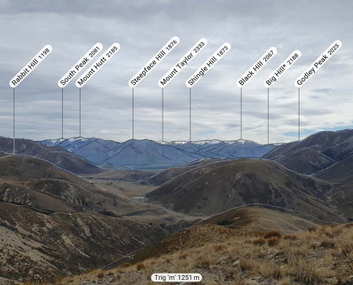 https://nzraw.co.nz/wp-content/uploads/2021/10/app-for-identifying-peaks.jpg
908
1210
Mark
https://nzraw.co.nz/wp-content/uploads/2020/06/nz-raw-logo.png
Mark2021-10-24 09:24:542022-04-09 08:37:53Identify Peaks with the PeakFinder App
https://nzraw.co.nz/wp-content/uploads/2021/10/app-for-identifying-peaks.jpg
908
1210
Mark
https://nzraw.co.nz/wp-content/uploads/2020/06/nz-raw-logo.png
Mark2021-10-24 09:24:542022-04-09 08:37:53Identify Peaks with the PeakFinder App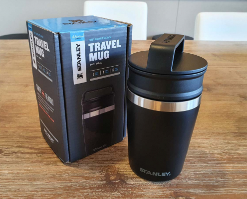 https://nzraw.co.nz/wp-content/uploads/2021/06/stanley-shortstack-adventure-travel-mug-and-box.jpg
908
1210
Mark
https://nzraw.co.nz/wp-content/uploads/2020/06/nz-raw-logo.png
Mark2021-06-27 17:36:282022-04-09 08:38:03Review of the Stanley Adventure Shortstack Travel Mug 8oz
https://nzraw.co.nz/wp-content/uploads/2021/06/stanley-shortstack-adventure-travel-mug-and-box.jpg
908
1210
Mark
https://nzraw.co.nz/wp-content/uploads/2020/06/nz-raw-logo.png
Mark2021-06-27 17:36:282022-04-09 08:38:03Review of the Stanley Adventure Shortstack Travel Mug 8oz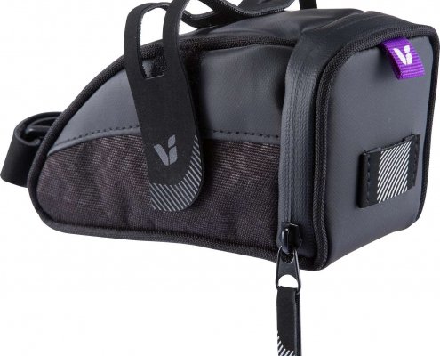 https://nzraw.co.nz/wp-content/uploads/2021/04/LIV_VECTA_SEAT_BAG.jpg
1313
1496
Mark
https://nzraw.co.nz/wp-content/uploads/2020/06/nz-raw-logo.png
Mark2021-04-25 10:59:302022-04-09 08:38:12The Best Small Bike Seat Bag: Liv Vecta
https://nzraw.co.nz/wp-content/uploads/2021/04/LIV_VECTA_SEAT_BAG.jpg
1313
1496
Mark
https://nzraw.co.nz/wp-content/uploads/2020/06/nz-raw-logo.png
Mark2021-04-25 10:59:302022-04-09 08:38:12The Best Small Bike Seat Bag: Liv Vecta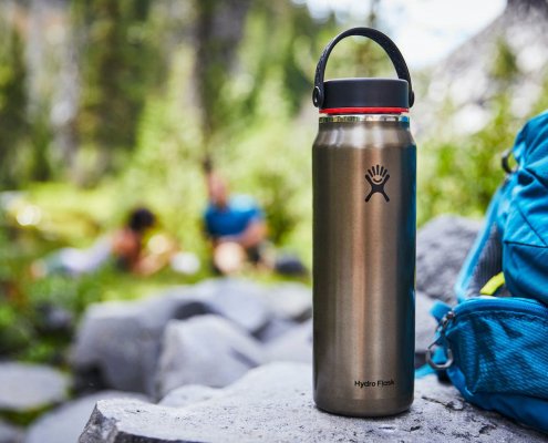 https://nzraw.co.nz/wp-content/uploads/2021/01/hydro-flask-trail-series-water-bottles.jpg
825
1100
Mark
https://nzraw.co.nz/wp-content/uploads/2020/06/nz-raw-logo.png
Mark2021-01-15 12:15:372021-05-03 09:01:26Hydro Flask Water Bottle Trail Series Review
https://nzraw.co.nz/wp-content/uploads/2021/01/hydro-flask-trail-series-water-bottles.jpg
825
1100
Mark
https://nzraw.co.nz/wp-content/uploads/2020/06/nz-raw-logo.png
Mark2021-01-15 12:15:372021-05-03 09:01:26Hydro Flask Water Bottle Trail Series Review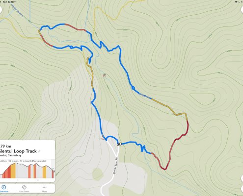 https://nzraw.co.nz/wp-content/uploads/2020/11/a-route-in-footpath-app.jpg
1199
1600
Mark
https://nzraw.co.nz/wp-content/uploads/2020/06/nz-raw-logo.png
Mark2020-11-23 10:56:252022-04-09 08:38:213 Mapping & Route Planning Apps for Hikers
https://nzraw.co.nz/wp-content/uploads/2020/11/a-route-in-footpath-app.jpg
1199
1600
Mark
https://nzraw.co.nz/wp-content/uploads/2020/06/nz-raw-logo.png
Mark2020-11-23 10:56:252022-04-09 08:38:213 Mapping & Route Planning Apps for Hikers

Leave a Reply
Want to join the discussion?Feel free to contribute!