Māori Rock Art Walk at Waikari
A 1.5-hour ‘out and back’ across hilly farmland that takes you to a site of Māori rock art. Waikari town itself features some nice cafés, outdoor picnic tables, a toilet block, and a few other interesting sites.
A relatively short drive from Christchurch, this 90 minute return walk takes you to a limestone outcrop with a large overhang, under which you’ll find some historic Māori rock art. The site is also known as ‘Weka Pass Historic Reserve’.
I couldn’t find anything to suggest when the art was created, but Māori activity in this region dates back between 600 to 1,000 years. While no doubt with good intentions along the lines of preservation, inexcusably the rock art was painted over with black and red house paint in 1929/1930. Canterbury Museum holds original tracings of the art (more info here).
I’ve added this to Alltrails here (pending at time of writing) and you can view our stats on Garmin, noting that we were at 3-year-old pace for the flat bits and I had her in a child carrier for the uphill bits.


Walk Overview
So it turns out there are a few places to start this walk. We missed the main one (probably because the local signage leans more towards the cartoon-graphics side rather than the boring-but-clearer informative side!) which you can find just before the Waikari Kitchens café*. Other information online about the start of the walk is a bit vague, so I’m here to make that specific! See maps of the two ‘trailheads’ below, and note that my map/trail recording is from the trail that starts at the west of the town centre.
*This café is amazing. We were expecting to find the usual canteen-style rural café with a few pies and bags of chips, and what we found was a café operated by a professional chef, with its own home-made food, including a carvery for roast pork sandwiches. You need to visit the café for breakfast or lunch. Even if you’re just driving through on your way to Hanmer. Stop at the café.


From either of these entrances, you’ll find yourself on an old railway formation that used to connect up with the Weka Pass Railway. Halfway along that is an obvious set of signs, a bench, and a stile to cross. After the stile, the path is simply a grassy/muddy trail through fields. Just stick with the fenceline up over the top of the hill and down into a valley. The fence is dotted with yellow markers to show you you’re on the right path.
At the top of the hill, you’ll be tempted to think the rock art is part of the large section of limestone rock features that appears to your left, but you’ll soon see a DOC sign and another stile, showing that the rock art can actually be found on the lone section of rock to the right instead.
From the rock art, it’s an about-face back the way you came. You’ll see another stile that leads further to the south, but I believe this just takes you to a farming access road and then back to the town via a longer – but more road-based – loop.
Note that the trail is on private farming land and dogs are not permitted at any stage.
Track to Weka Pass Historic Reserve
- The track is over a private walking farm
- Keep to the marked route
- Do not approach cattle or horses
- Act responsibly and leave everything as you find it
Clairview Farm, Phone 027 655 0191


Waikari’s old railway formation.

This is where you leave the railway formation and start heading up the hill.

Head up this hill to the top, following the fence.

Looking back down the hill. Follow the yellow fence markers.

Wandering around the tops.

Limestone outcrop to the east (rock art is to the west, or to the right of this photo).
Suitability
A fair bit of the walk is up a reasonably steep hill, but it’s not for very long and you’re never really far from the main road or the town. The path is on a working farm.
Our 6 year old had no issues at all, while our 3 year old needed to jump in our child carrier for the steep sections. We did this walk following rain and a few sections were a little slippy. The limestone rock itself is also deceptively slippy in a few areas. Care is required, but it’s not like you need mountaineering boots, just something with a little traction.
If it’s a hot day, you’ll be wanting to take a good amount of water for the uphill slogs.
 https://nzraw.co.nz/wp-content/uploads/2024/07/mackintosh-beach-waipara-walks-10.jpg
1067
1600
Mark
https://nzraw.co.nz/wp-content/uploads/2020/06/nz-raw-logo.png
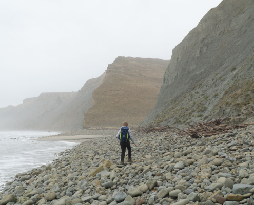
Mark2024-07-21 15:34:162024-07-21 15:54:27MacKintosh Beach Family Walk Near Waipara, North Canterbury
https://nzraw.co.nz/wp-content/uploads/2024/07/mackintosh-beach-waipara-walks-10.jpg
1067
1600
Mark
https://nzraw.co.nz/wp-content/uploads/2020/06/nz-raw-logo.png
Mark2024-07-21 15:34:162024-07-21 15:54:27MacKintosh Beach Family Walk Near Waipara, North Canterbury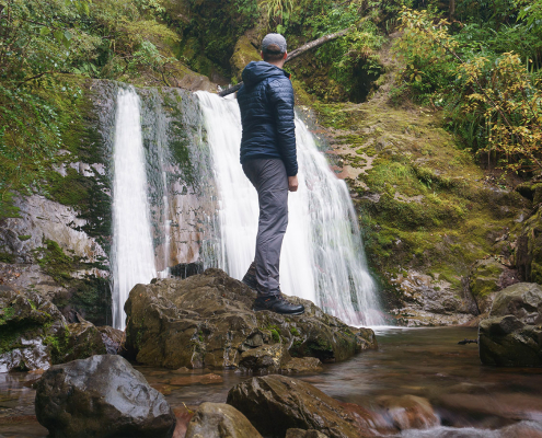 https://nzraw.co.nz/wp-content/uploads/2023/06/picture-takashima-jacket-review-new-zealand.jpg
908
1210
Mark
https://nzraw.co.nz/wp-content/uploads/2020/06/nz-raw-logo.png
Mark2023-06-30 08:57:142023-06-30 08:57:14Review of the Picture Takashima Jacket
https://nzraw.co.nz/wp-content/uploads/2023/06/picture-takashima-jacket-review-new-zealand.jpg
908
1210
Mark
https://nzraw.co.nz/wp-content/uploads/2020/06/nz-raw-logo.png
Mark2023-06-30 08:57:142023-06-30 08:57:14Review of the Picture Takashima Jacket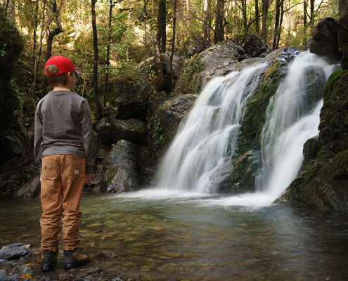 https://nzraw.co.nz/wp-content/uploads/2023/01/waterfalls-nz-800x600-1.jpg
600
800
Mark
https://nzraw.co.nz/wp-content/uploads/2020/06/nz-raw-logo.png
Mark2023-01-06 16:46:302023-01-11 13:30:04Best Family Friendly Waterfalls of Mid-South Island New Zealand
https://nzraw.co.nz/wp-content/uploads/2023/01/waterfalls-nz-800x600-1.jpg
600
800
Mark
https://nzraw.co.nz/wp-content/uploads/2020/06/nz-raw-logo.png
Mark2023-01-06 16:46:302023-01-11 13:30:04Best Family Friendly Waterfalls of Mid-South Island New Zealand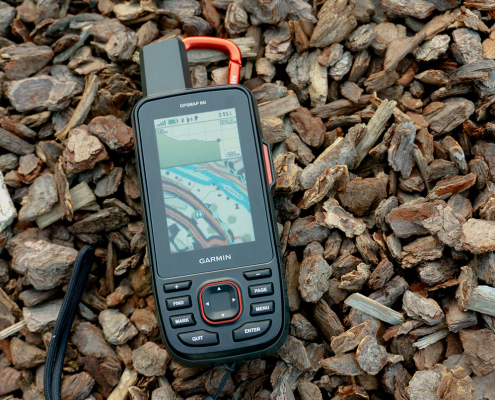 https://nzraw.co.nz/wp-content/uploads/2022/04/garmin-66i-gps-showing-map.jpg
806
1210
Mark
https://nzraw.co.nz/wp-content/uploads/2020/06/nz-raw-logo.png
Mark2022-04-23 16:15:202023-06-28 13:41:39Why I chose a Garmin 66i inReach GPS device
https://nzraw.co.nz/wp-content/uploads/2022/04/garmin-66i-gps-showing-map.jpg
806
1210
Mark
https://nzraw.co.nz/wp-content/uploads/2020/06/nz-raw-logo.png
Mark2022-04-23 16:15:202023-06-28 13:41:39Why I chose a Garmin 66i inReach GPS device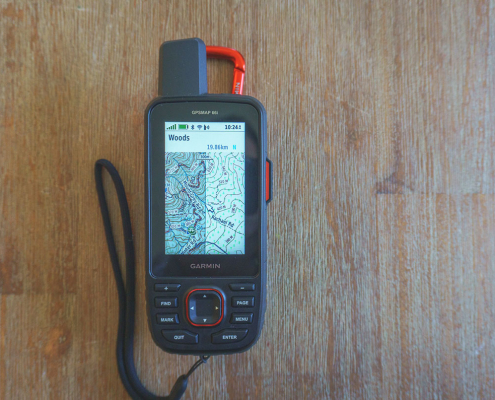 https://nzraw.co.nz/wp-content/uploads/2022/04/garmin-66i-showing-new-zealand-topo-50-maps-1.jpg
806
1210
Mark
https://nzraw.co.nz/wp-content/uploads/2020/06/nz-raw-logo.png
Mark2022-04-09 12:12:282022-04-23 16:08:42How to add NZ topo maps to a Garmin GPS device (for free)
https://nzraw.co.nz/wp-content/uploads/2022/04/garmin-66i-showing-new-zealand-topo-50-maps-1.jpg
806
1210
Mark
https://nzraw.co.nz/wp-content/uploads/2020/06/nz-raw-logo.png
Mark2022-04-09 12:12:282022-04-23 16:08:42How to add NZ topo maps to a Garmin GPS device (for free)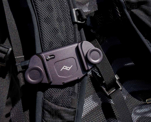 https://nzraw.co.nz/wp-content/uploads/2022/01/review-peak-design-capture-clip-v3.jpg
908
1210
Mark
https://nzraw.co.nz/wp-content/uploads/2020/06/nz-raw-logo.png
Mark2022-01-08 16:08:332022-04-09 08:37:28Peak Design Capture Clip v3 Review
https://nzraw.co.nz/wp-content/uploads/2022/01/review-peak-design-capture-clip-v3.jpg
908
1210
Mark
https://nzraw.co.nz/wp-content/uploads/2020/06/nz-raw-logo.png
Mark2022-01-08 16:08:332022-04-09 08:37:28Peak Design Capture Clip v3 Review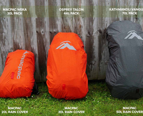 https://nzraw.co.nz/wp-content/uploads/2021/11/macpac-rain-covers-on-packs.jpg
1067
1600
Mark
https://nzraw.co.nz/wp-content/uploads/2020/06/nz-raw-logo.png
Mark2021-11-13 18:07:322022-04-09 08:37:40Macpac Waterproof Pack Cover Sizing
https://nzraw.co.nz/wp-content/uploads/2021/11/macpac-rain-covers-on-packs.jpg
1067
1600
Mark
https://nzraw.co.nz/wp-content/uploads/2020/06/nz-raw-logo.png
Mark2021-11-13 18:07:322022-04-09 08:37:40Macpac Waterproof Pack Cover Sizing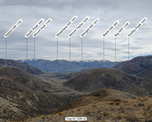 https://nzraw.co.nz/wp-content/uploads/2021/10/app-for-identifying-peaks.jpg
908
1210
Mark
https://nzraw.co.nz/wp-content/uploads/2020/06/nz-raw-logo.png
Mark2021-10-24 09:24:542022-04-09 08:37:53Identify Peaks with the PeakFinder App
https://nzraw.co.nz/wp-content/uploads/2021/10/app-for-identifying-peaks.jpg
908
1210
Mark
https://nzraw.co.nz/wp-content/uploads/2020/06/nz-raw-logo.png
Mark2021-10-24 09:24:542022-04-09 08:37:53Identify Peaks with the PeakFinder App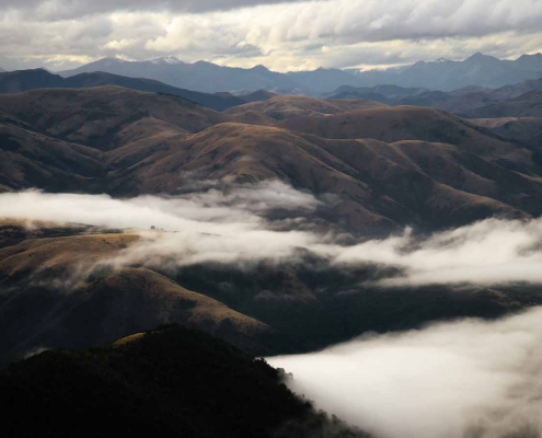 https://nzraw.co.nz/wp-content/uploads/2021/07/mt-thomas-walk-canterbury-08.jpg
900
1600
Mark
https://nzraw.co.nz/wp-content/uploads/2020/06/nz-raw-logo.png
Mark2021-07-18 12:47:582021-07-18 12:50:53Mount Thomas Walk in North Canterbury
https://nzraw.co.nz/wp-content/uploads/2021/07/mt-thomas-walk-canterbury-08.jpg
900
1600
Mark
https://nzraw.co.nz/wp-content/uploads/2020/06/nz-raw-logo.png
Mark2021-07-18 12:47:582021-07-18 12:50:53Mount Thomas Walk in North Canterbury

Leave a Reply
Want to join the discussion?Feel free to contribute!